
Spend less time searching.
More time valuing.
Land registry, listings, local prices, environmental risks: gather the information on a property without jumping from one website to another. PickItSmartly helps you prepare your valuation and present its elements in a report.
01Map and cadastre
Find all the property information in one place.
Locate the plot, the buildings and their surroundings. Historical aerial views and linked listings give you first elements to check on site or ask the owner about.
The available tools
2D and 3D map
Satellite and topographic backgrounds of your choice.
Multiple plots
Select several plots on the map.
Plot record
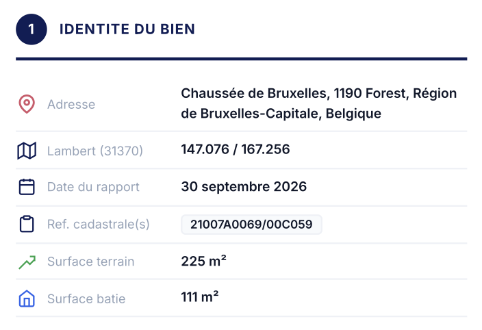
Cadastral identifier, surface area and linked addresses.
Measurements
Distances, areas and perimeters directly on the map.
Aerial photos
Historical views, depending on availability.
Historical views are not enough to confirm a property’s planning compliance.
02Risks and environment
Identify what can weigh on the property’s value.
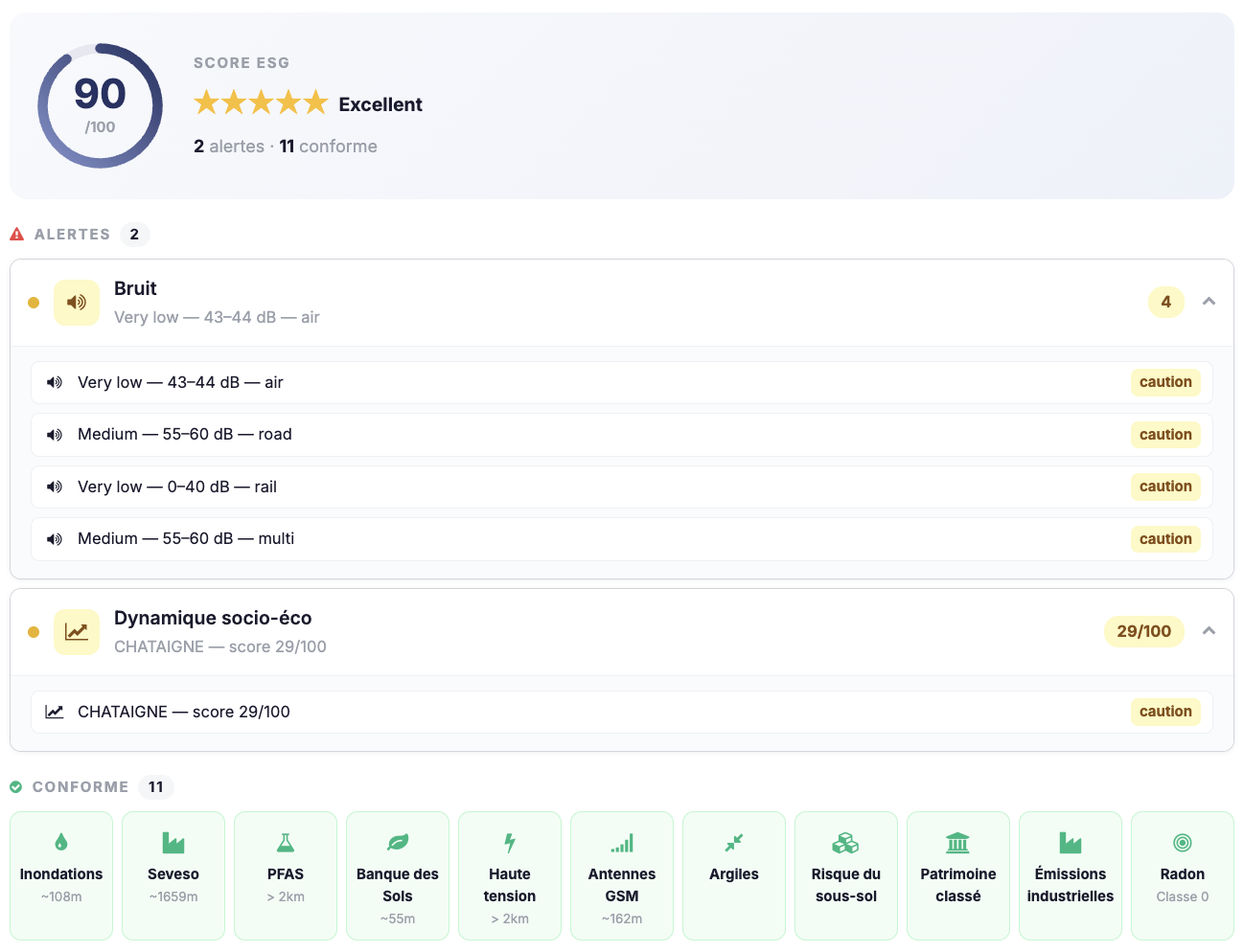
A flood zone, a noise source or a potentially polluted site nearby deserves a closer look. Find the alerts on the map to prepare your checks and your discussions with the client.
The available tools
Risks
Flooding, noise, soil pollution, Seveso, industrial emissions, PFAS, radon, subsoil (clays, mining concessions, karst), high-voltage lines and other available data.
Living environment
Air quality, heat islands, sealed soils and biodiversity, remarkable trees and hedges, listed heritage, mobility, amenities, healthcare provision and accessibility.
Local references
Socio-economic data, property price layers and median EPC label of the locality.
Available data and its level of detail vary by location.
03Comparables and market
References to support your valuation.
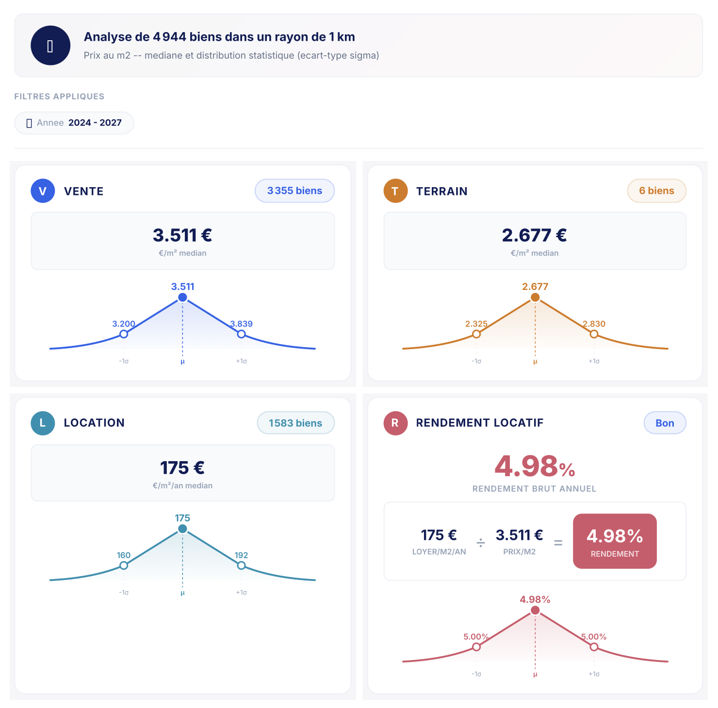
Find properties close to the one you are studying and choose the relevant references. Local prices, rents and yields help you support your opinion and discuss it with your client.
The available tools
Prefilled filters
Automatically set from the subject property.
Filters and sorting
Type, price, surface areas, EPC, bedrooms, distance, publication period…
Detailed records
Photos, description and characteristics, shareable via a link.
Comparable selection
One by one or by drawing a zone on the map.
Local statistics
Median prices and price ranges per m², within radii of 500 m to 10 km.
Gross rental yield
Calculated from observed rents and prices.
AI market commentary
To be reviewed and checked before inclusion in the report.
Listing prices are asking prices. The statistics and yields derived from them do not necessarily reflect the prices finally negotiated.
04Automated valuation
A first estimate to confront with your analysis.
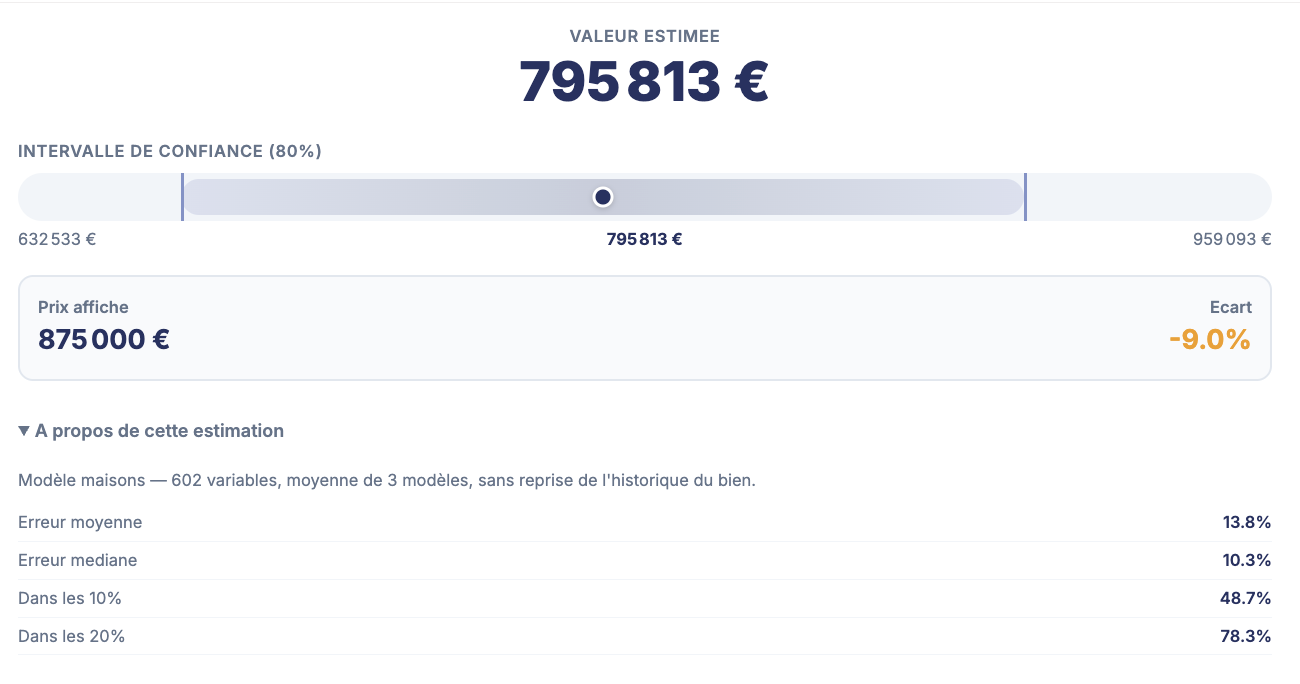
Enter the characteristics of a house or apartment to get an indicative estimate and a value range. You can compare this result with the comparables you selected and what you observed at the property.
The available tools
Property characteristics
Form for the home, with optional photos.
Value and range
Indicative value presented as an 80% confidence interval.
The automated valuation does not replace a property valuation by an expert.
05Reports and exports
Your research brought together in a report.
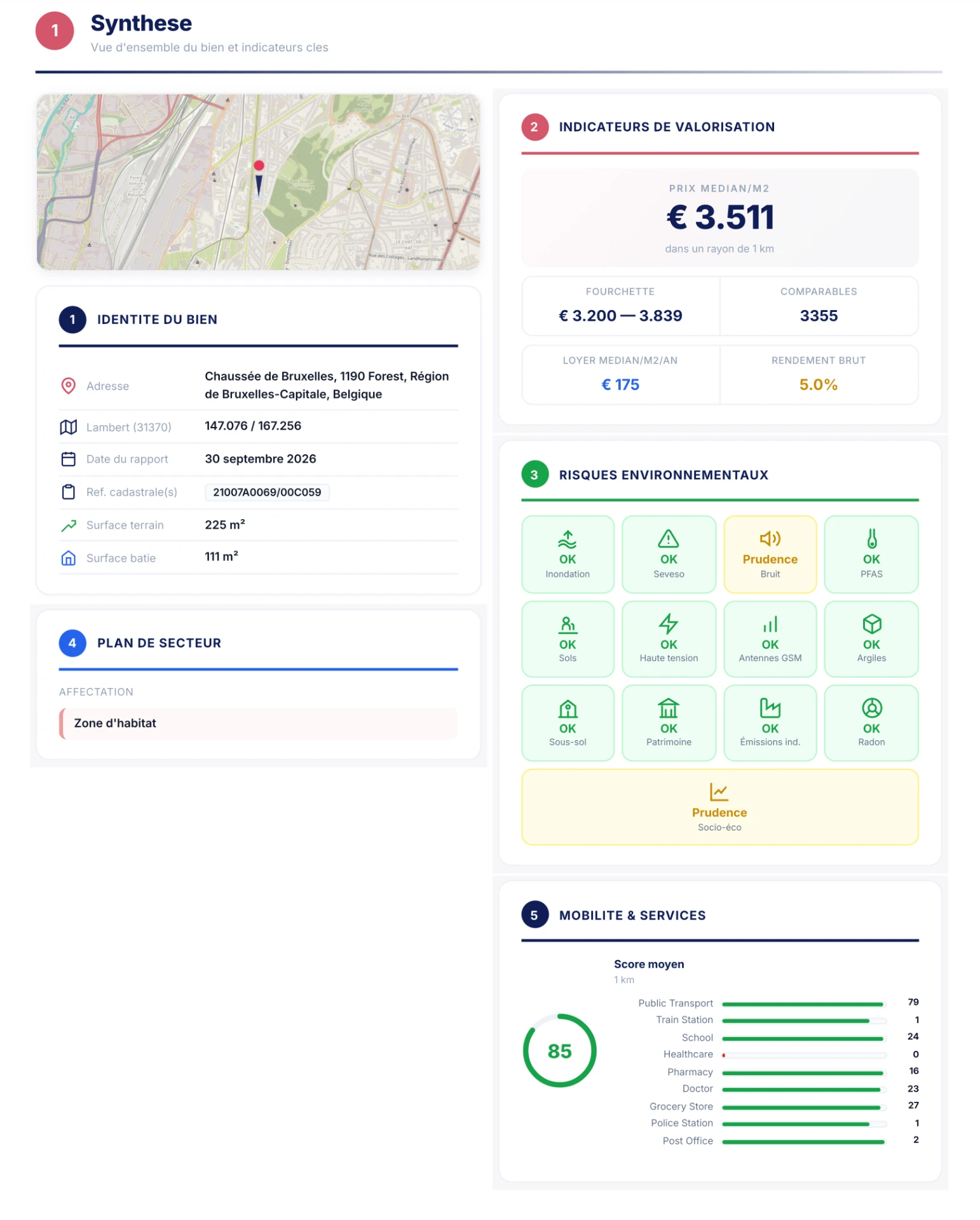
Find the elements kept during your analysis in a customisable report. Choose the sections relevant to the file, then export the result to send it or continue your work.
The available tools
Sections of your choice
Analysed property, comparables, sales, rental and land statistics, yield, flood, Seveso and noise risks, AI market commentary.
Statistics radius
Choice of radius, from 500 m to 10 km.
ChatelainXpert connection
Using the file number.
Discover what PickItSmartly can bring to your daily work.
See how to prepare a search, choose your comparables and build your report during a demo with our team.